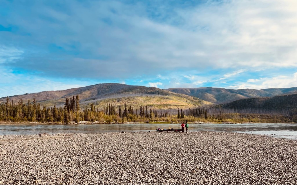
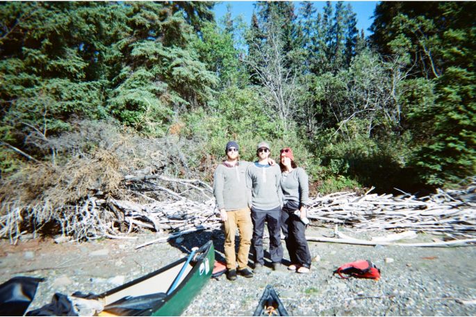
What started as an idea around a campfire on our previous paddling trip through BC’s Turner Lakes chain, turned into an awesome reality. Paddling the Yukon River from Whitehorse to Dawson City is a journey you will likely not forget. Running an impressive 3000 km+, the Yukon River can be a fun weekend adventure or a summer expedition. Our group chose to cover the approximately 700 km section between Whitehorse and Dawson City, which we completed in 9 days in September of 2023.
This post provides a detailed itinerary and account of our trip, but if you’re curious about the logistics of how exactly we planned this trip, check out our other post here. If you love adventure and wild places, keep reading to find out how our paddle went, where we camped, and much more!
Note: We highly suggest purchasing a copy of Mike Rourke’s book, Yukon River – Marsh Lake to Dawson City. This guide was extremely helpful and provides a detailed guide to the river and its extensive history. For every day we will provide page numbers from the book to use as a guide.
Day 1 (Sept. 1, 2023) – Whitehorse to Laberge Creek
Travelled 39 km, Campsite Coordinates: 60.981493, -135.040478, Mike Rourke’s Guidebook pages 61 to 64
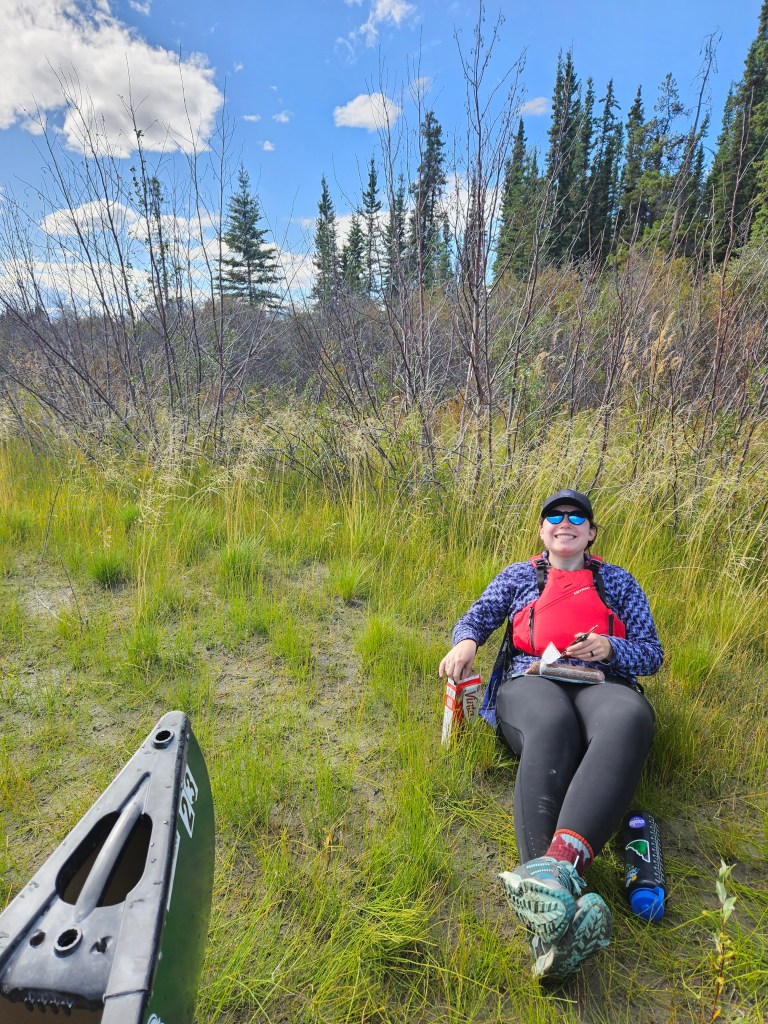
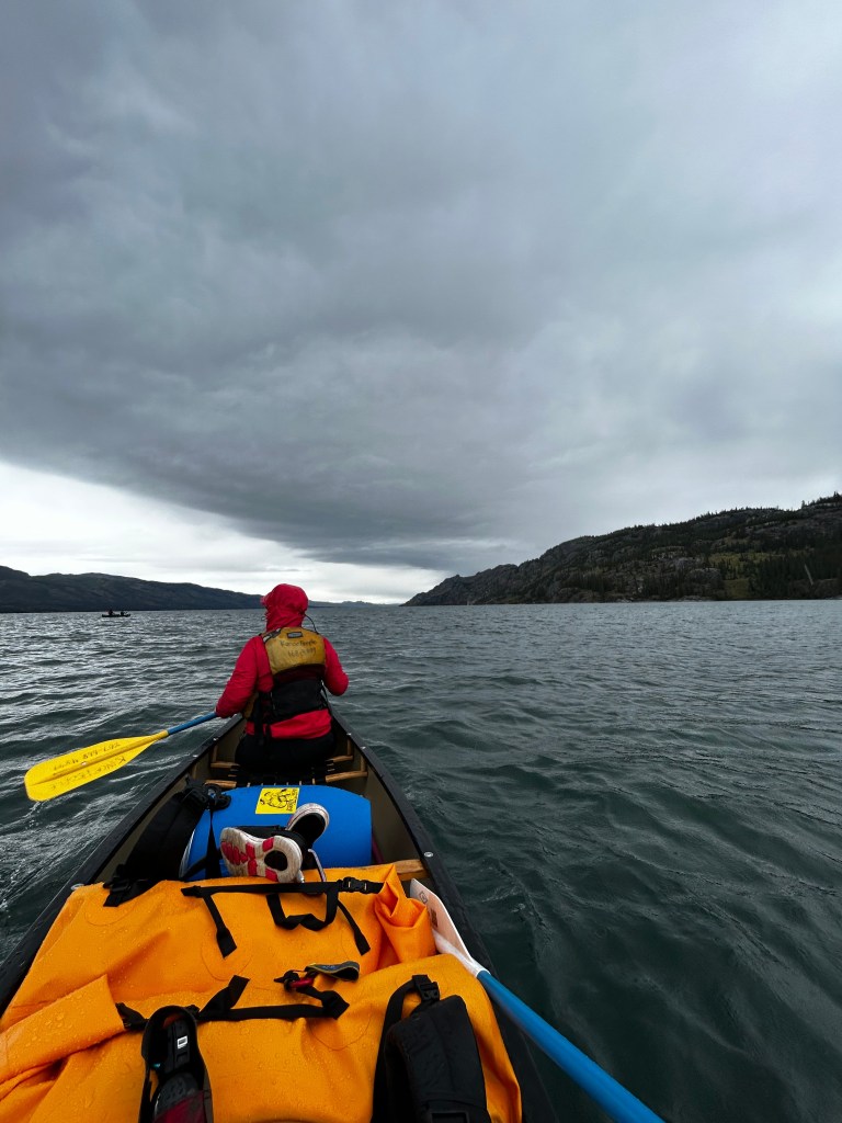
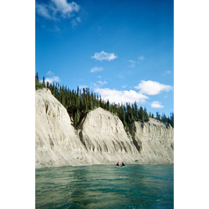
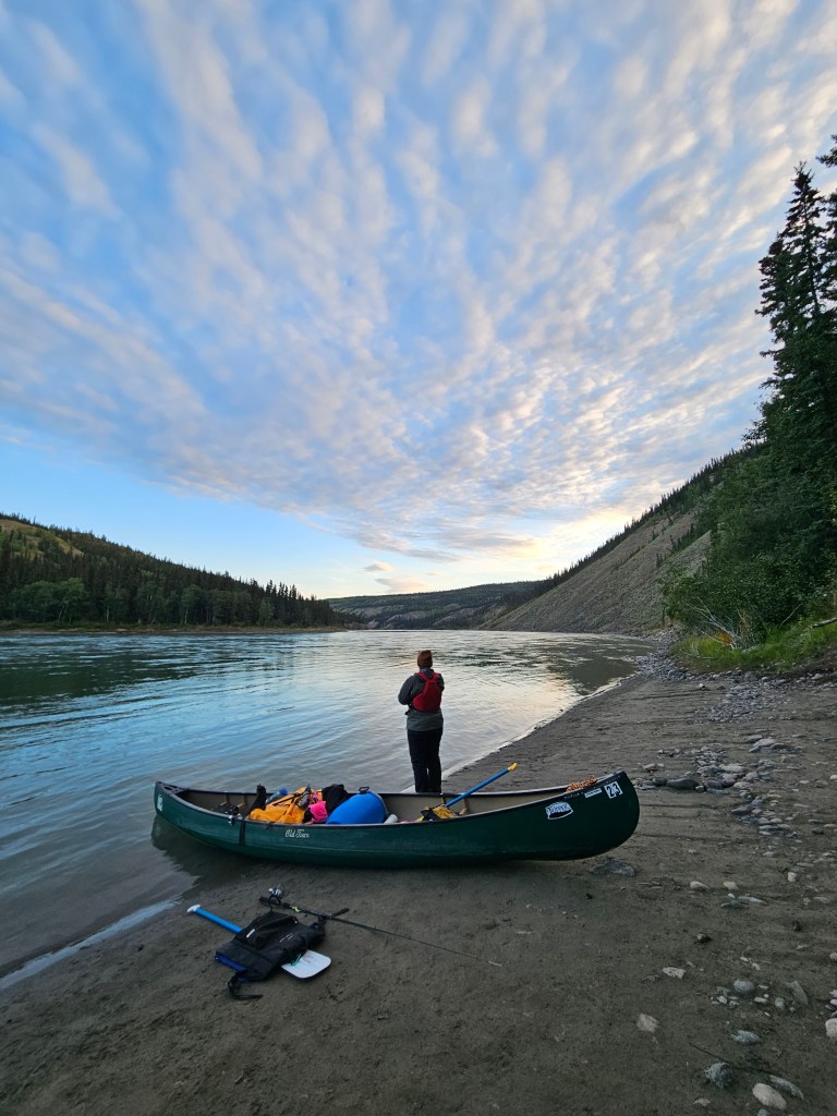
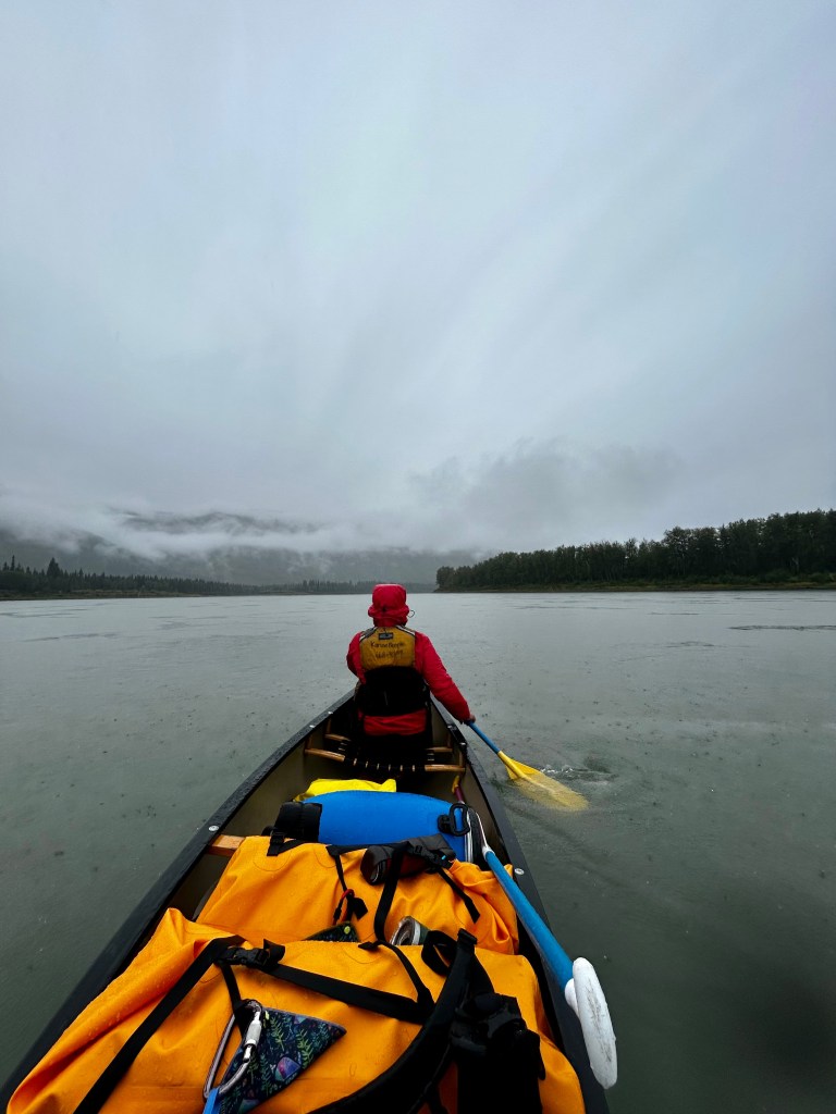
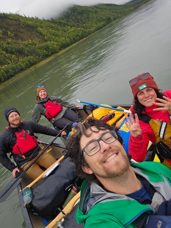
Our first day on the Yukon River began with a taxi ride to Kanoe People from the Robert Service Campground. After unloading our gear and barrels, we checked in with Scott, who outfitted us with our paddling gear and canoes. Scott was friendly and knowledgeable. As we tried on lifejackets and selected paddles, we chatted with him about how to approach our adventure. We were most concerned about navigating the massive Lake Laberge. Fifty kilometres in length, with towering rock walls, and ever-changing winds it can be daunting to even experienced paddlers. Originally, we had planned to traverse the lake via the west side, which is known for its many sheltered bays and gentler topography. However, Scott suggested we paddle the east side since the river outlet is on this side. After a daunting paddle, some do not want to paddle another 12 km across the lake from west to east to reach the river. With this insider knowledge in hand, we loaded our canoes and pushed off beginning our 9-day journey.
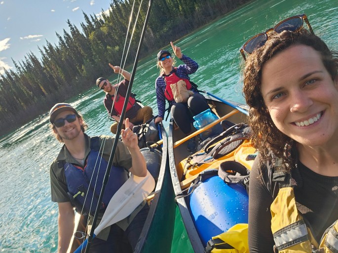
Excited to begin, we drifted out of Whitehorse, already lucky enough to have a wildlife encounter. Within 30 minutes of starting our journey, we spotted a beautiful bull caribou having a drink from the river. The first stretch of the Yukon, from Whitehorse to Lake Laberge is swift and before you know it, you are reaching the seemingly unending expanse of the lake. Brimming with excitement, we soaked up the sunny day spotting many bald eagles, ducks, and gulls. Following Scott’s recommendation to take the east-side route, we experienced our first strong wind entering the lake which forced us to seek out camp for the night between Laberge and Joe Creek.
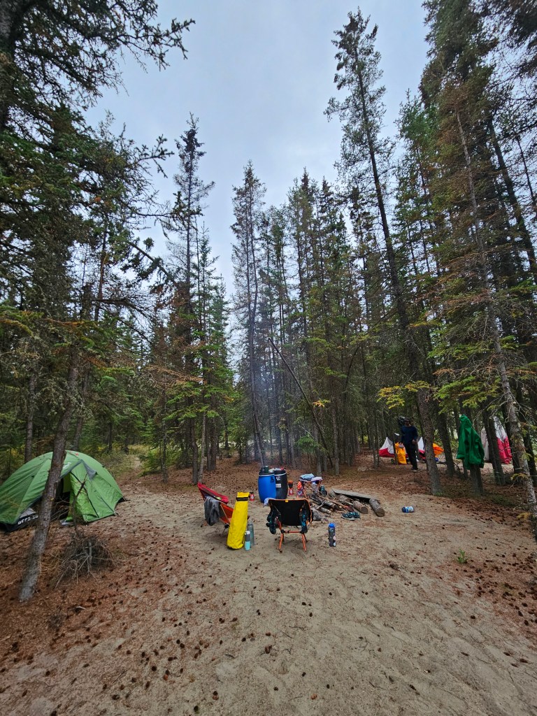
Our impromptu campsite was sandy, had plenty of dry firewood, and was sheltered from the wind by a wall of black spruce and shrubs along the shore. We got busy setting up our tents, dug a firepit, and came up with a plan of attack for our first real crack at Laberge. After a restful afternoon enjoying the first taste of our adventure, we crawled into our tents, hopeful for a calmer lake and an early start the next morning.
Day 2 (Sept. 2, 2023) – Laberge Creek to LLRC Site 6,
Travelled 35.5 km, Campsite Coordinates: 61.277887, -135.220926, Mike Rourke’s Guidebook pages 58 to 61
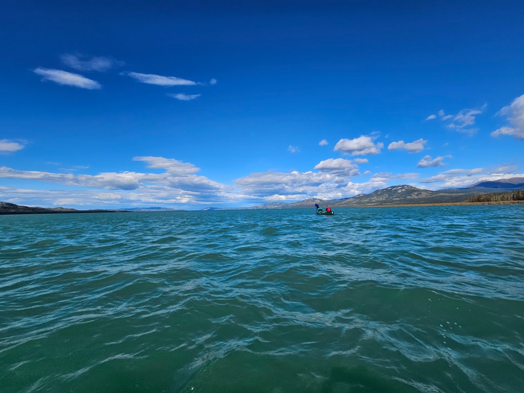
Starting at 7 am to avoid strong afternoon winds, we set out to conquer the lake. The morning started strong, and we were able to paddle for two hours before stopping to change clothes and have a quick snack. Throughout the day, paddling conditions were variable with changing winds. At times, a strong tailwind pushed us along, and the boys were able to successfully use a sail they constructed. Other times, we faced a headwind that had our boat at a standstill, with waves coming in over the stern.
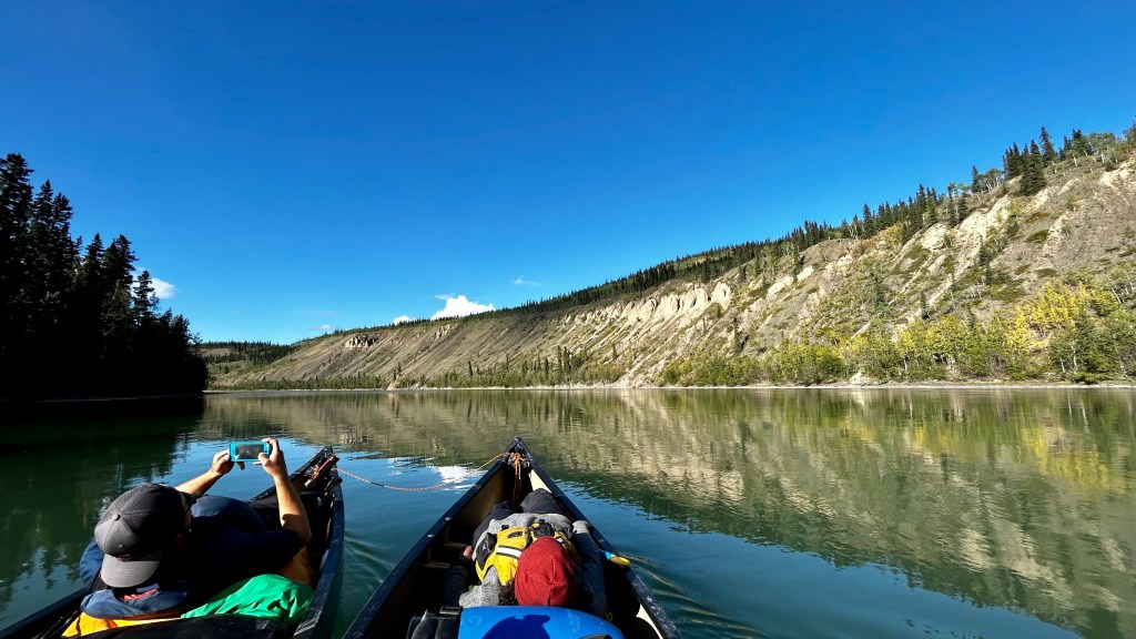
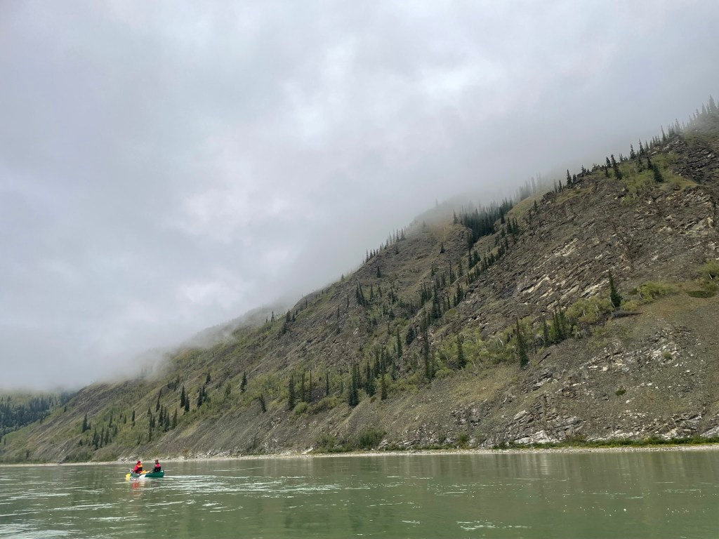
The lake is scenic and the landscapes are vast with knobby hillsides dotted with small trees, grasses, and exposed rock. The further down the lake we paddled, the taller and more rugged the cliffs became. Just after lunch, we finally reached a landmark that we had been using as our directional guide for most of the day after 22 km of paddling. Pushing forward, we had a mid-afternoon stretch and snack break on a beautiful gravel beach. Lake Laberge’s waters were clear and blue and watching the weather move across the expanse of open water was mesmerizing.
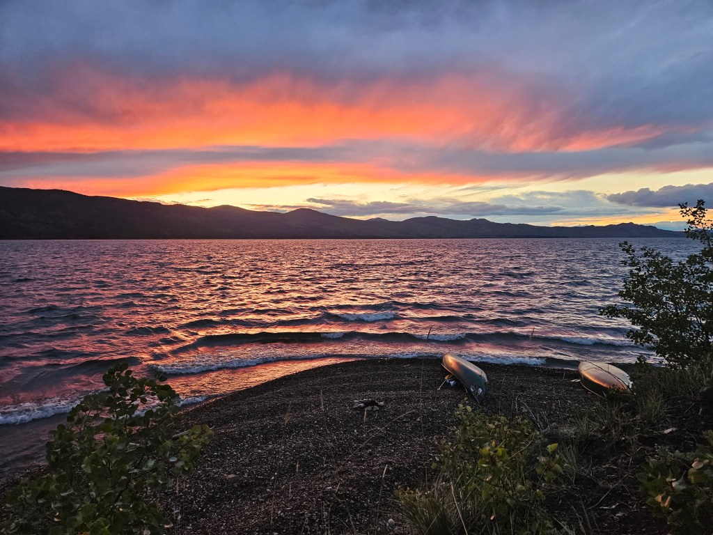
We found camp for the night after a few failed attempts of searching in sheltered bays. We stumbled across a maintained, boat access camp managed by the Laberge Renewable Resource Council (LLRC). Situated above a sandy beach was a rough wilderness site with a backcountry toilet and fire ring. Tired and a little chilly from a wet and windy day, we set up camp and got a good fire going. Mother Nature rewarded our hard day of paddling with a beautiful sunset. We settled in for the evening with homemade backpacker’s chilli, butter ripple schnapps, and the satisfaction of having paddled 35 km of the lake.
Day 3 (Sept. 3, 2023) – LLRC Site 6 to Davis Point
Travelled 67 km, Campsite Coordinates: 61.623557, -134.844506, Mike Rourke’s Guidebook pages 54 to 58
After a good night’s sleep, we pushed on along the lake. The morning was brisk, but we were greeted with a tailwind that kept us cruising along the final stretch of the lake. Along our way to the river outlet, we discovered another LLRC boat access backcountry site (page 57 of guidebook). With the last 13 km of lake paddling behind us, we re-entered the Yukon River, marking the beginning of the scenic and historic 30 Mile River section.
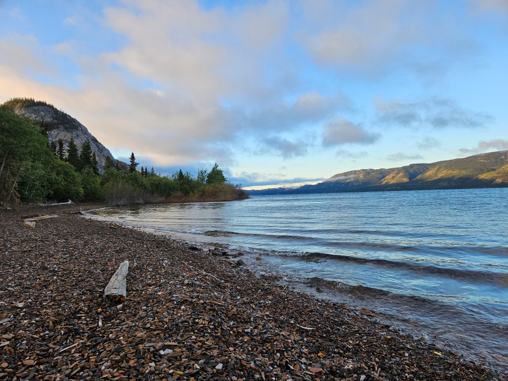
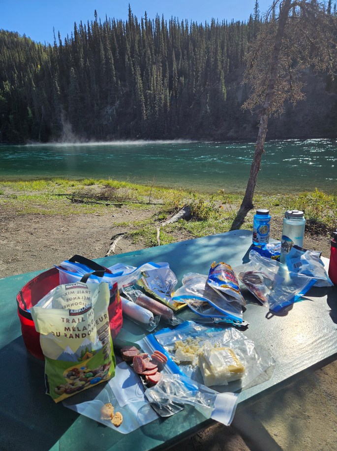
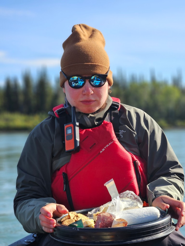
Designated as a Canadian Heritage River in 1991, 30 Mile River is known for its steep cutbanks, crystal blue waters, and remote recreational opportunities. With the sun shining overhead, we quickly drifted through this narrow and scenic portion of the river stopping to have lunch at US Bend Camp #2 (page 56 of guidebook). Backcountry charcuterie is a small luxury our group always looks forward to on these trips.
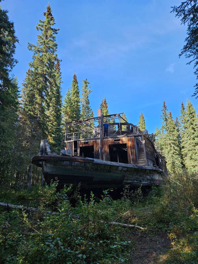
We stopped again to see the final resting place of the streamer SS Evelyn (also know as the Norcom). The steamer was supposedly damaged and left on Shipwreck Island after its internal machinery was removed and used in the Keno, which is now on display in Dawson City. It is highly recommended to visit this site while paddling this stretch of the river.
Known for its historical landmarks and natural beauty, 30 Mile River was where we saw the most people during our 9-day trip. We even had the pleasure of watching a floatplane land and take off at Shipwreck Island. After exploring the area, we continued a bit further downriver and camped at a well-used spot with lots of room for our tents. There was a short hike that brought us to the top of one of the many cutbanks for a beautiful view of the sunset.
Day 4 (Sept. 4, 2023) – Davis Point to Selkirk Rock
Travelled 84 km, Campsite Coordinates: 61.990636, -135.436023, Mike Rourke’s Guidebook pages 49 to 54
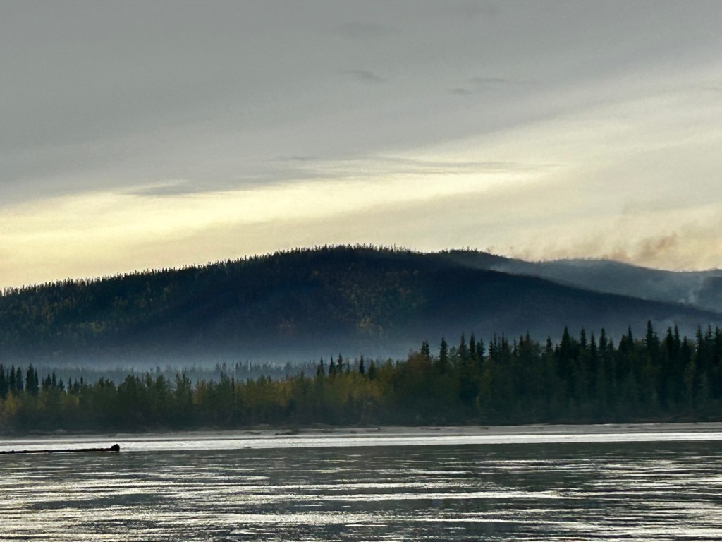
With a chilly start to the day, we set off on our first full day on the river. Our morning started filled with smoke from a nearby wildfire, but we continued on and as it lifted, we stopped for a stretch on a large gravel bar. From there, we enjoyed a beautiful view of a mosaic of fire scars on the vast mountains. Paired with the beautiful blue-green river, this was one of our favourite pit stops on our trip.
The landscape during this stretch was varied with rolling hills, cutbanks, and low-lying areas. We saw no other humans, but were kept in almost constant company by majestic Bald Eagles and flocks of grebes along the way. Stopping at Big Salmon for lunch, we explored the old village site. Big Salmon still had residents until 1995, when a fire unfortunately destroyed the remaining buildings of the historic village. It is located where the Big Salmon River meets the Yukon.
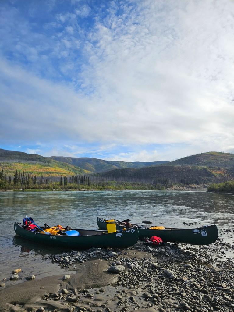
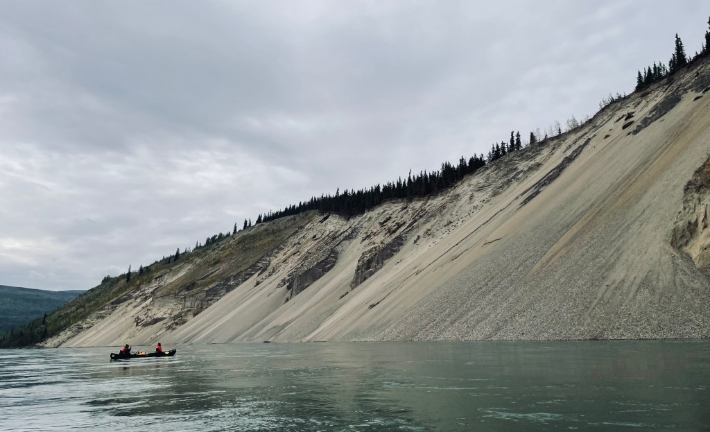
In the latter half of the day, we passed the largest cutbanks of the paddle. Their towering walls were mesmerizing, with rocks of various sizes tumbling down into the water below. We camped for the night at Selkirk Rock, a large, sandy site with thousands of spruce seedlings sprouting in the newly deposited sand from the river. This site had lots of room and across a small stream, we found another site that could easily accommodate a few tents. Enjoying a dinner of bulked up ramen we enjoyed our camp and the sandy tent pads that made for a very comfortable sleep.
Day 5 (Sept. 5, 2023) – Selkirk Rock to Five Finger Coal Mine
Travelled 101 km, Campsite Coordinates: 62.206208, -136.335360, Mike Rourke’s Guidebook pages 44 to 49
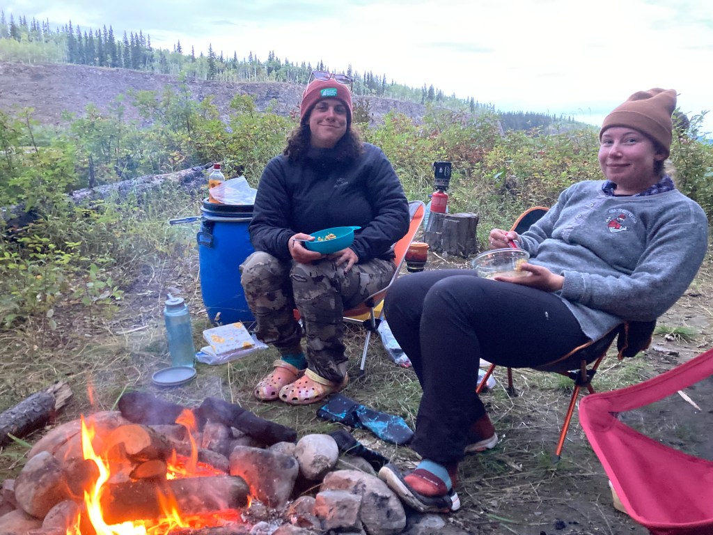
We had beautiful weather on our fifth day of the paddle. There was a birthday to celebrate for a member of our group, so spirits were high and we were thoroughly taking advantage of the warm and sunny weather. We passed through more rolling hills, sandy banks, and striking rock bluffs. Along the way, we spotted a black bear wandering the shore, as well as many eagles perched by the river’s edge.
We arrived in Carmacks, the only town we passed through on our journey. We went ashore for some Hawkins cheezies, ice cream sandwiches, and a new pair of sunglasses for Whitney, who sadly lost hers in the river on our third day. Our brief dip back into civilization was short lived and we continued on deciding to stop at the well-used Five Finger Coal Mine campsite. There was lots of room here for tents and the site was tucked into a large river bend with a sandbar not too far off shore.
We decided to brave the cold river after a warm day in the sun and took a dip. There is nothing quite like a cold dip after a long paddle or hike to rejuvenate the soul! We settled in for a homemade backcountry meal of shepherd’s pie and birthday s’mores for dessert. We stayed up until the fire burned low and the sun was down, then we went to bed and rested up for our early morning run through Five Finger Rapids.
Day 6 (Sept. 6, 2023) – Five Finger Coal Mine to Black Creek
Travelled 118 km, Campsite Coordinates: 62.825524, -137.643961, Mike Rourke’s Guidebook pages 36 to 44
Starting the day with mist rolling across the river we left our camp and headed downriver to the Five Finger Rapids. Sticking to the right, we passed through them with little turbulence due to the late summer water levels. The right channel was blasted in 1902 to allow easier passage by the steamboats that once travelled the waterways frequently. Just past the calmer Rink Rapids, we saw what we think was a pine marten running along the shore of the river. About an hour later, Whitney and I spotted a young black bear strolling a gravel bar at the river’s edge.
We spent most of the day cruising the river, only stopping to use the washroom when needed. During lunch and snack stops, we tied the boats together and enjoyed the sights and sounds of the river. With the current fast in this area, we covered a lot of ground even without paddling. As we wound through complexes of islands, passing massive beaver lodges, and the small village of Minto, we saw another group of paddlers in the distance stopping at the town. Just outside the tiny town, we spotted a herd of about 40 mountain goats on the hillsides above us. We floated on, using binoculars to watch them graze and move about.
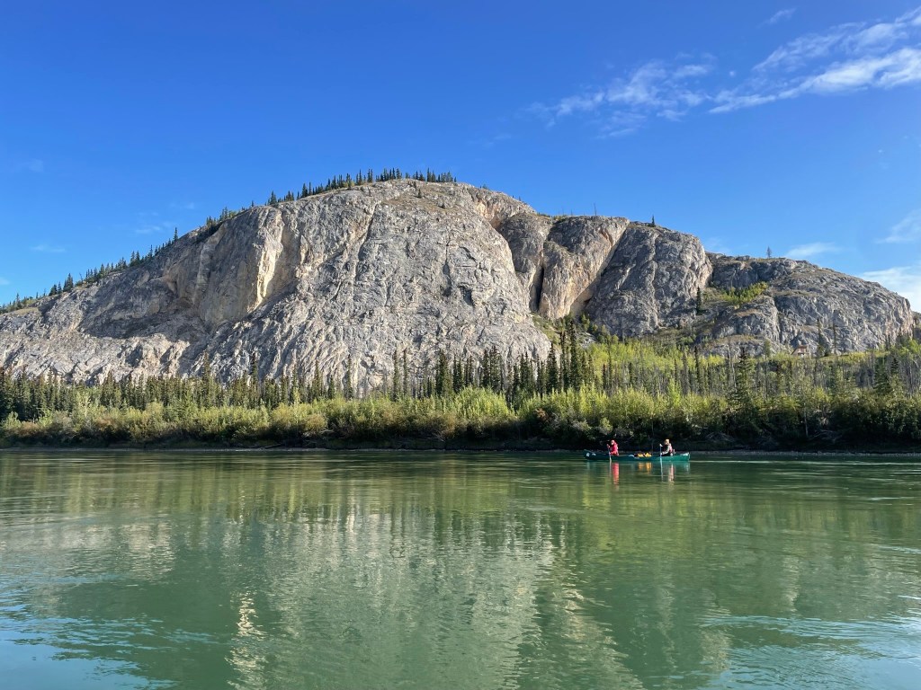
After winding through the willow flood plains, we finally reached the infamous basalt walls, indicating that we had reached the unglaciated portion of the Yukon. We stopped at Fort Selkirk to view the historical site, which is well preserved and its remote nature makes it even more impressive. It’s fascinating to think the Yukon River once bustled with activity and travellers, while we had encountered so few people on our journey.
We pushed another 20 km downriver to the next “good camp” illustrated in our guidebook. As we navigated between the numerous islands with the basalt wall on our right side, we almost missed the camp located on an island near Black Creek. It was obvious high spring water levels had washed away the trail leading up to the camp, making it hard to distinguish from the water.
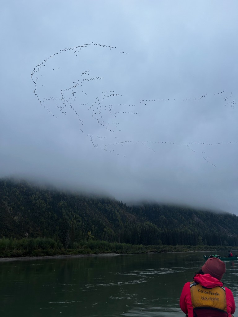
We pulled off and set up camp after 118 km and 12 hours on the water. The camp at Black Creek is well-sheltered and has room for multiple tents. With a fire started, we chowed down on our homemade backcountry yellow curry – a crew favourite. As we soaked up the sunset, we heard birds calling overhead and went to the treeline to see where the noise was coming from. We were amazed to see hundreds of Sandhill Cranes flying overhead, continuing to pass by for the rest of the evening. This made our day feel even more magical and we were in awe of the wildness of the country surrounding us.
Day 7 (Sept. 7, 2023) – Black Creek to Isaac Creek
Travelled 53.5 km, Campsite Coordinates: 62.828259, -138.507775, Mike Rourke’s Guidebook pages 33 to 36
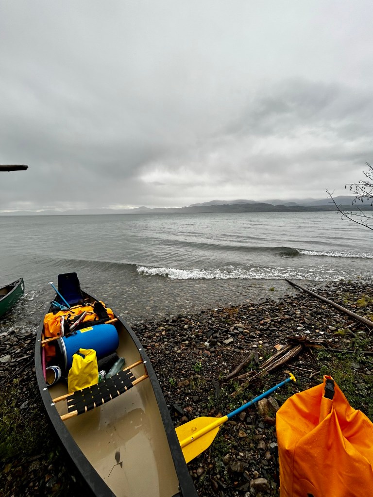
Not long after we began our day, the skies opened up, and a torrential rain started – not a drizzle, but straight-up raining cats and dogs. We pushed forward until we all needed a break to use the bathroom and change some clothes. This was a day on the water where we all questioned why exactly we had decided to do this? Type 2 fun was our best guess… After lunch, we decided we needed to pull off, and picked the next camp near Isaac Creek as our stopping point for the day.
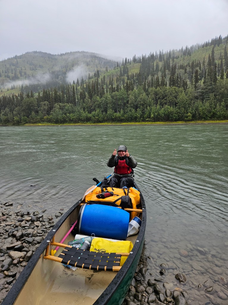
Although the weather was not the best we’ve had, the views along the river once again changed. Tall mountains now surrounded us, and the river was dotted with sizable permanent islands and impressive gravel bars. We pulled into our camp, drenched to the bone, but were greeted by a magnificent golden eagle that took flight as we hiked up the bank to explore. The camp was a well-used hunting camp, complete with an old outhouse and two bear-in-area signs. We later found evidence of said bear by one of the largest scat piles any of us have ever seen. We made sure to make lots of noise and kept our food cache, cooking area, and sleeping areas well separated. Our bear spray was within easy reach when we went to bed that night.
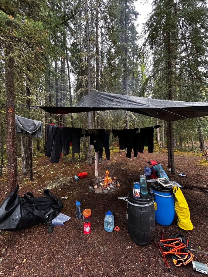
We got to work setting up tarps and starting a fire, which took about two hours to be self-sustaining. Thankfully, in the later afternoon, the rain ceased, the clouds lifted, and the evening turned beautiful. This allowed us to hang and dry out our gear and spend the night without getting our tents soaked.
The small bay in front of the campsite was picturesque, with a large island creating a barrier between us and the main river channel. There was a pair of bald eagles in a nest residing there, and we were lucky enough to see that they had fledglings. We spent part of the evening listening to them and exploring the beautiful sandbars on the island. With a hearty dinner of pulled pork bowls, we all decided that although it was a tough day the ending was quite superb!
Day 8 (Sept. 8, 2023) – Isaac Creek to Stewart Island
Travelled 99 km, Campsite Coordinates: 63.310289, -139.424258, Mike Rourke’s Guidebook pages 25 to 33
Continuing through the beautiful mountainous valley, we started the morning with some mist, but thankfully no rain. The trees along this section of the river were quite mixed, with some very interesting vertical Black Spruce bogs on the mountain slopes. We saw several hundred more sandhill cranes flying low beneath the clouds, their calls echoing off the mountains and reverberating down to the river below. Later that morning, we saw two families of beavers, two moose, and lots of ducks, adding to the wildlife count for the day.
Later in the day, the sun came out for a little bit and we were blessed with the best wildlife encounter of our trip. We came around a bend, and noticed a young grey wolf trotting along the gravel bar closest to us. After a lot of whisper shouting and frantic arm waving, our group stopped paddling and drifted along as the wolf, unbothered, passed by us heading upstream. It had a beautiful grey and black coat and it looked curiously at us as we passed by. This magical moment became one of the highlights of our paddle.
We did not see any other humans, but did see a sizable passenger plane land at a copper mine that we passed, and further downriver, we spotted a barge landing, as well as some cabins in the distance. The river and the landscape changed once again as we reached the confluence of the Milk River, where the river slowed and widened. Our afternoon was spent paddling into a headwind that was reminiscent of paddling flat water. The river widens significantly with many islands and channels to navigate. We struggled to find a decent camp but eventually, came across a sheltered sandy camp on Stewart Island.
Day 9 (Sept. 9, 2023) – Stewart Island to Dawson City
Travelled 106 km, Mike Rourke’s Guidebook pages 18 to 25
Exiting our sandy beach camp ended up being more challenging than expected. We immediately got caught up on a sneaky gravel bar, and after the confluence of the Milk River, the Yukon’s waters became silty, making navigating more challenging. Out we got to push the canoe over the bar and into more open water. Who doesn’t love ice-cold water on their feet in the morning? Now wide awake, we paddled through a vast valley full of islands, passing another actively burning wildfire. The fire provided another beautiful natural mosaic to the landscape, creating a stunning backdrop as we paddled on.
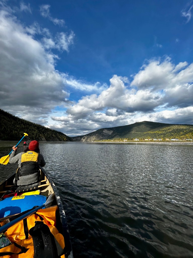
Halfway through the day, we confirmed our plan from the night before: we would complete our paddle to Dawson City. This was bittersweet for us all. After 9 days on the water, we had a routine going, and the thought of re-entering civilization seemed daunting. The further north we paddled, the more signs of fall we saw. Today, we noticed the changing of leaves on the hillsides, signalling winter’s quick approach. Our only indication that we were nearing Dawson City was a large barge and two motorboats. The river had once again turned deep blue as we reached the small town situated on the banks of the Yukon River – our final destination.
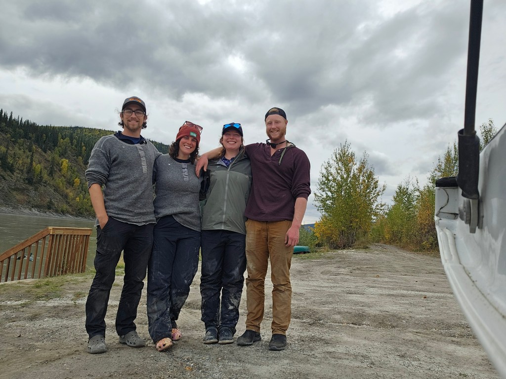
As we pulled onto shore, we unloaded our gear, cleaned out our canoes and began figuring out how to retrieve the truck from the airport where it was parked. Celebratory shots of fireball were taken, and we were excited to explore Dawson City and have a non-dehydrated meal after our adventure. A journey that started as a “what if” around the campfire during our last canoe trip had become a reality and surpassed our expectations. As Robert Service’s poem The Spell of the Yukon explains, this vast and at times vicious land was spell-binding. It left us with memories that will last a lifetime and a great appreciation for the truly wild spaces.
For more on the logistics of this trip, check out our other blog post here.
safety
There are many guided trips down the Yukon River, which can be a great option if you do not have a lot of backcountry experience. However, for those doing self-guided trips, like we did, it’s essential to inform someone of your trip plan and carry all the necessary gear, including survival equipment – don’t forget your bear spray!
It’s possible that you may not encounter anyone during your trip, especially in the off-peak months. For instance, we didn’t see anyone for 4 or 5 days after leaving Minto, it wasn’t until we reached Dawson City that we encountered people. If you need emergency assistance, help will take time to arrive, and a satellite communication device like an InReach, is highly recommended.
If you’re paddling Lake Laberge, be prepared for rough conditions. The wind speed and direction can change multiple times a day. If the conditions become too challenging, it’s best to get off the lake and wait for the weather to calm down.
Discover more from
Subscribe to get the latest posts sent to your email.

What a great paddling adventure! I am excited to see what you encounter on your next adventure.
LikeLike